Lot 0 Kozy Kove Road, Burnt Lake
Property Overview - For sale
| Price | $ 225 000 | On the Market | 8 days |
|---|---|---|---|
| MLS® # | X12097857 | Type | |
| Bedrooms | Bed | Bathrooms | 0 Bath |
| Waterfront | Burnt Lake | Postal Code | K0M1C0 |
| Street | Kozy Kove | Town/Area | Kawartha Lakes (Burnt River) |
| Property Size | 160 FT|1/2 - 1.99 acres | Building Size | 0 ft2 |
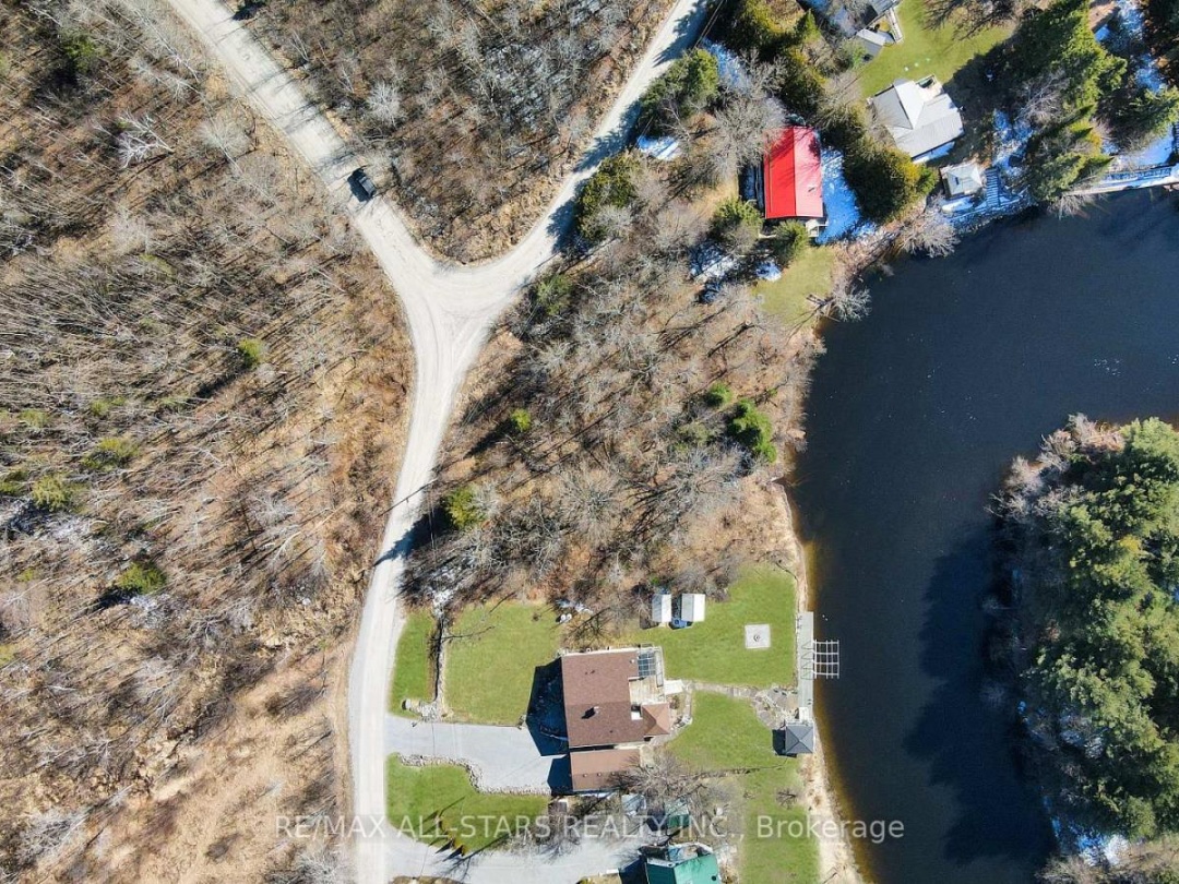
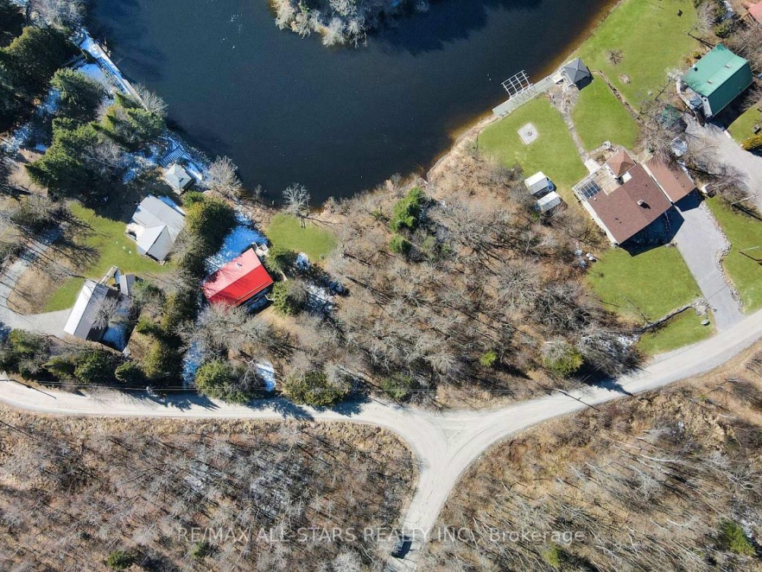
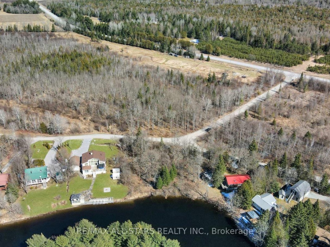
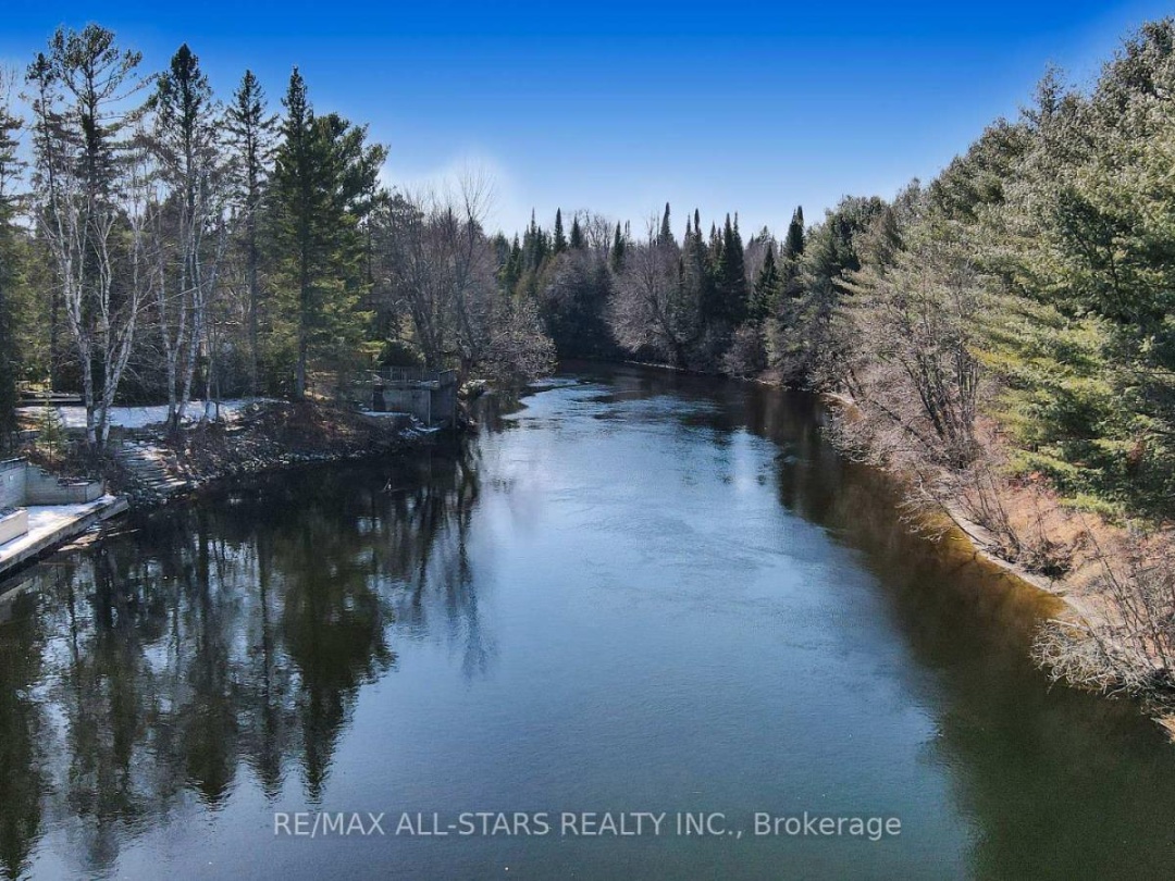
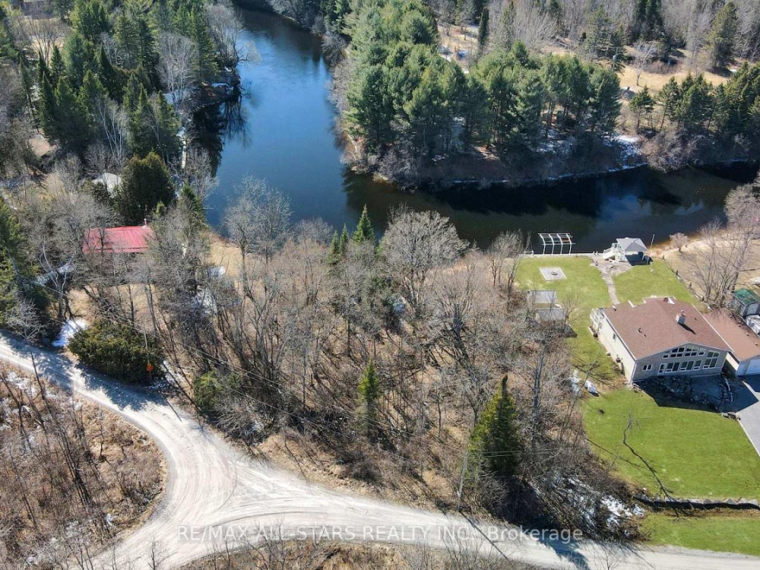
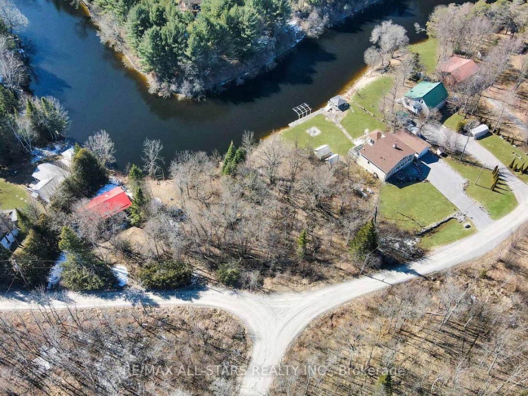
Located in a quiet rural neighbourhood of Burnt River, this 0.59 acre lot offers great possibilities. Accessible via County Rd 121, the property boasts 160 feet of waterfront on the Burnt River. The lot has recently had some bush clearing done. Located approximately 15 minutes to Fenelon Falls, Bobcaygeon and Kinmount areas. (id:60084)
| Waterfront Type | Waterfront |
|---|---|
| Waterfront | Burnt Lake |
| Size Total | 160 FT|1/2 - 1.99 acres |
| Size Frontage | 160 |
| Lot size | 160 FT |
| Zoning Description | LSR (F) |
This listing of a Vacant Land property For sale is courtesy of from
Information on Burnt Lake
| Burnt Lake Size | 22 Ha | 54 acres |
|---|---|---|
| Burnt Lake Perimeter | 5.20 km | 14 miles |
| Burnt Lake Depth | 11 m | 72 ft |
| Burnt Lake Mean Depth | 4.80 m | 16 ft |
| Altitude of Burnt Lake | 225 m | 738 ft |
| District | Burnt Lake is in the District of Parry Sound | |
| Municipality | Burnt Lake is in the Municipality of Archipelago | |
| Township | Burnt Lake is in the Township of Conger | |
| Drainage Basin | Moon River | |
| Watershed Area | 3.8 km | 2 miles |
| Water Clarity | Burnt Lake has a water clarity of 6.80 m | 22 ft |
Census Data of Archipelago Municipality
2016 Population of Archipelago: 5312011 Population of Archipelago : 566
Population Growth of Archipelago : -7 %
Total private dwellings in Archipelago : 2,693
Dwellings by residents in Archipelago : 251
Density of Archipelago : 251 per sq km
Land Area of Archipelago: 251 sq km
Archipelago is in the District of Parry Sound
Census Data for The District of Parry Sound
Population: 42,824 (2016) 1.6% increase over 2011 population of 42,162The total number of dwellings is 35,226 of which 18,679 are full time residents
The land area of Parry Sound is 9,326 sq km's (3,601 sq miles) and has a density of 5 per sqare km
Data is from the 2016 Government Census