137 Fell Station Drive, Burnt Lake

Property Overview - House For sale
| Price | $ 889 999 | On the Market | 2 days |
|---|---|---|---|
| MLS® # | X12186241 | Type | House |
| Bedrooms | 4 Bed | Bathrooms | 2 Bath |
| Waterfront | Burnt Lake | Postal Code | K0M1N0 |
| Street | Fell Station | Town/Area | Kawartha Lakes (Somerville) |
| Property Size | 117.4 x 130.4 FT | Building Size | 139 ft2 |
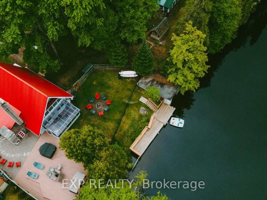
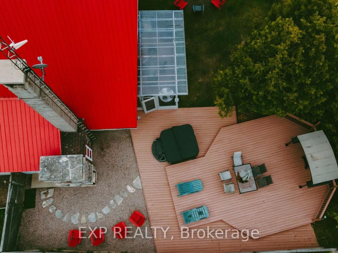
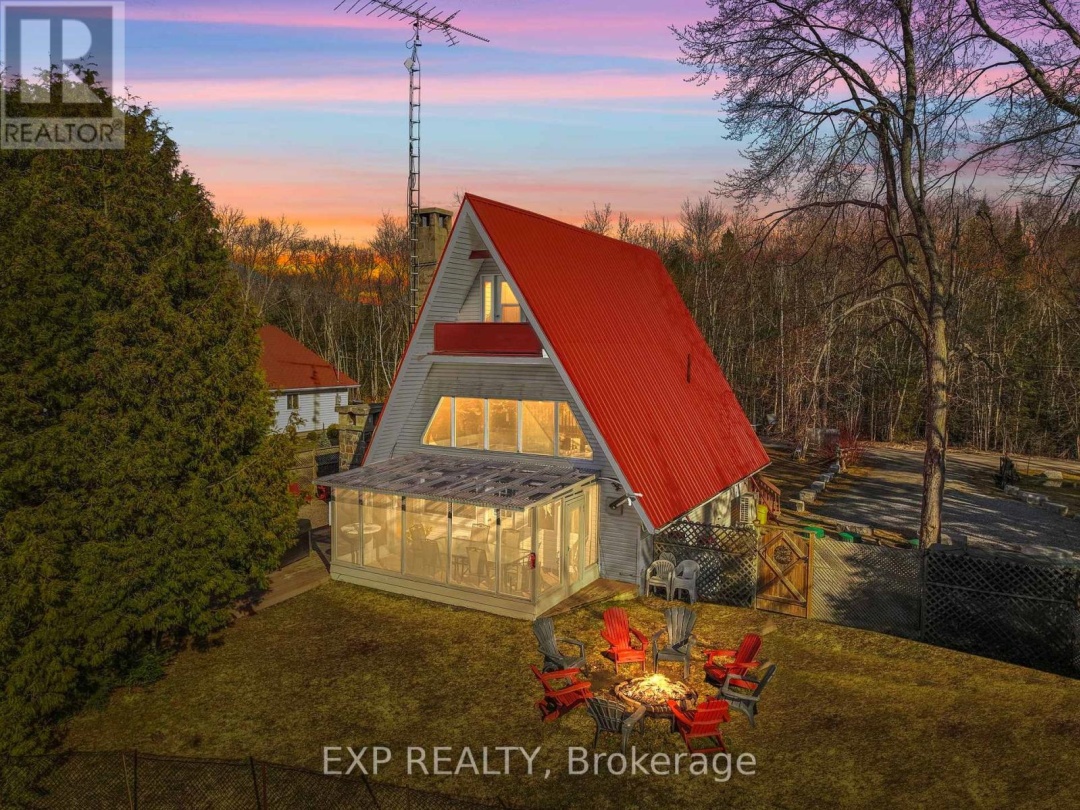
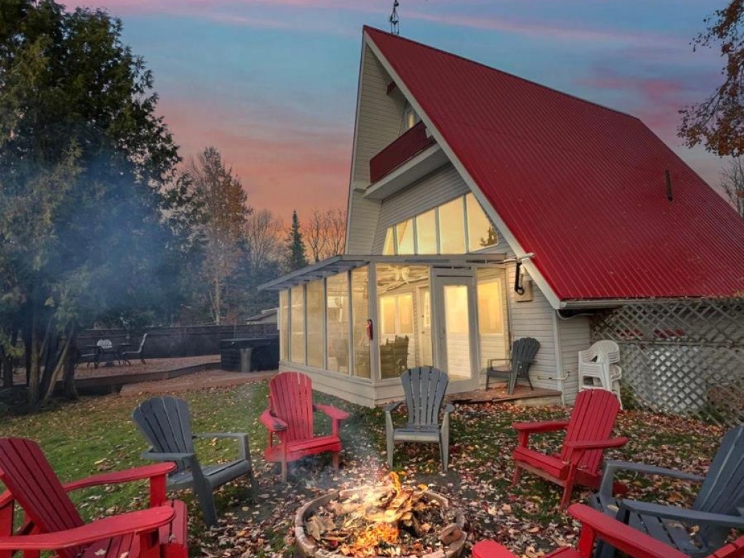
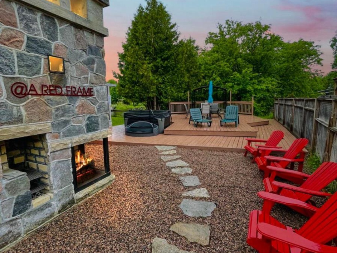
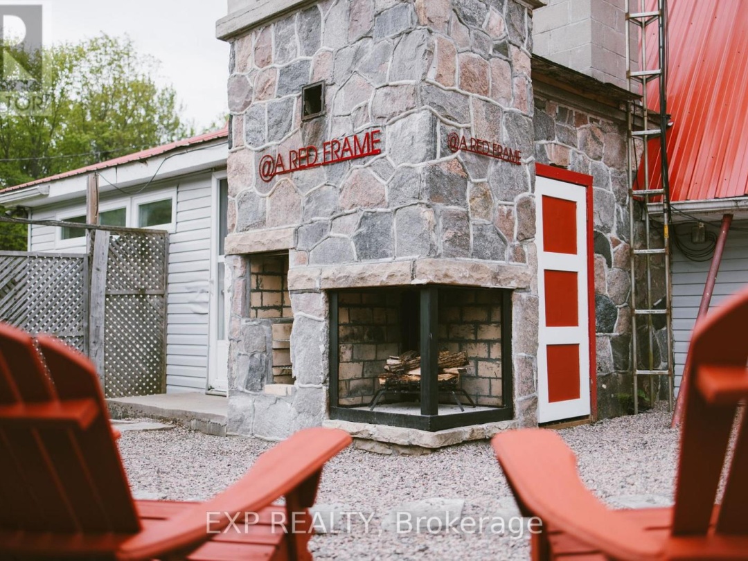
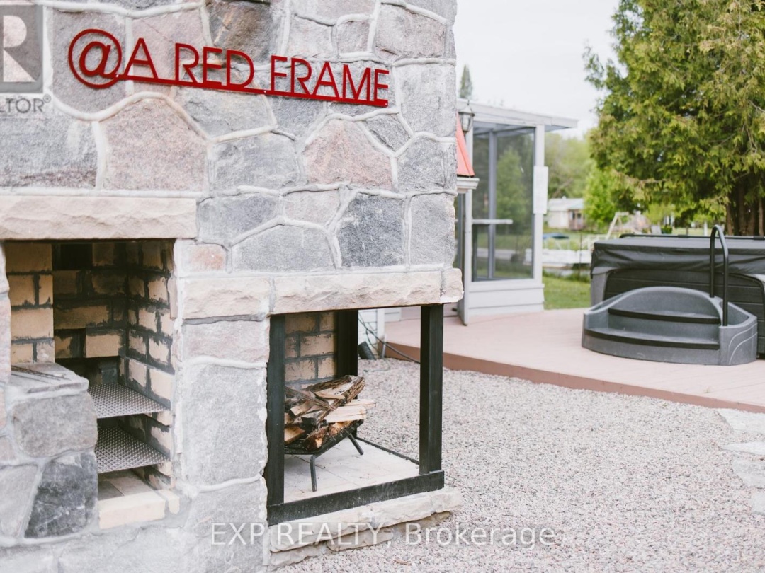
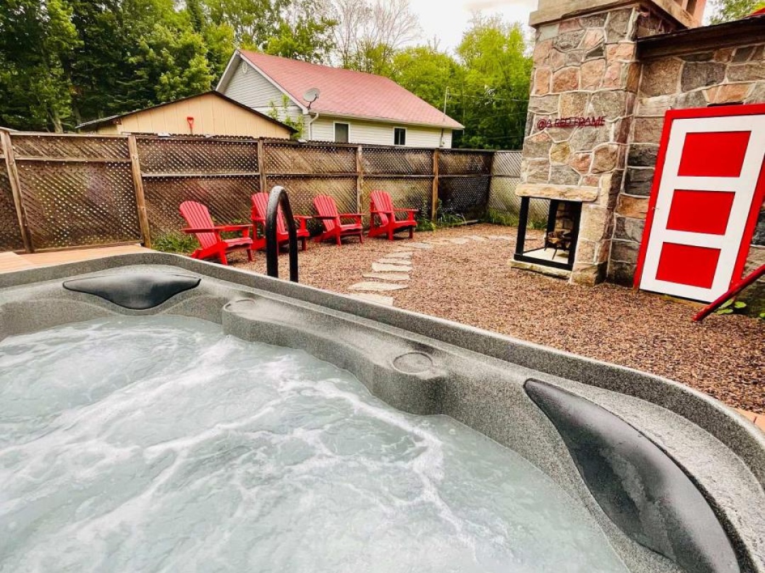
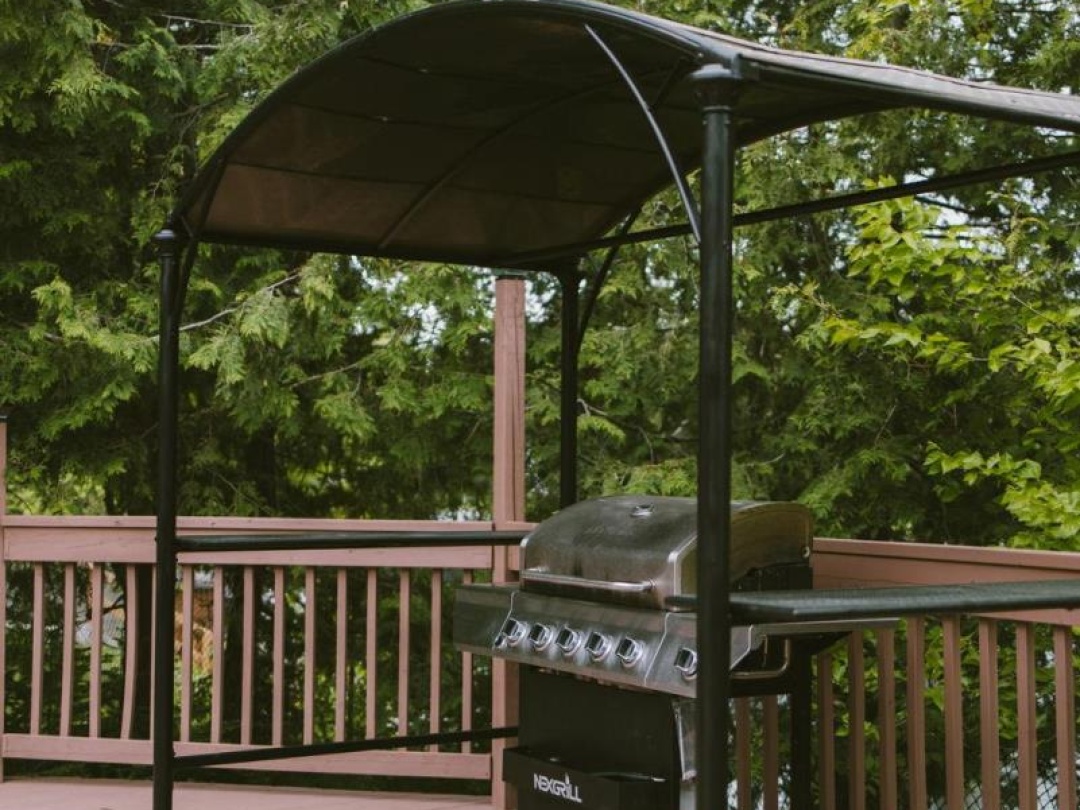
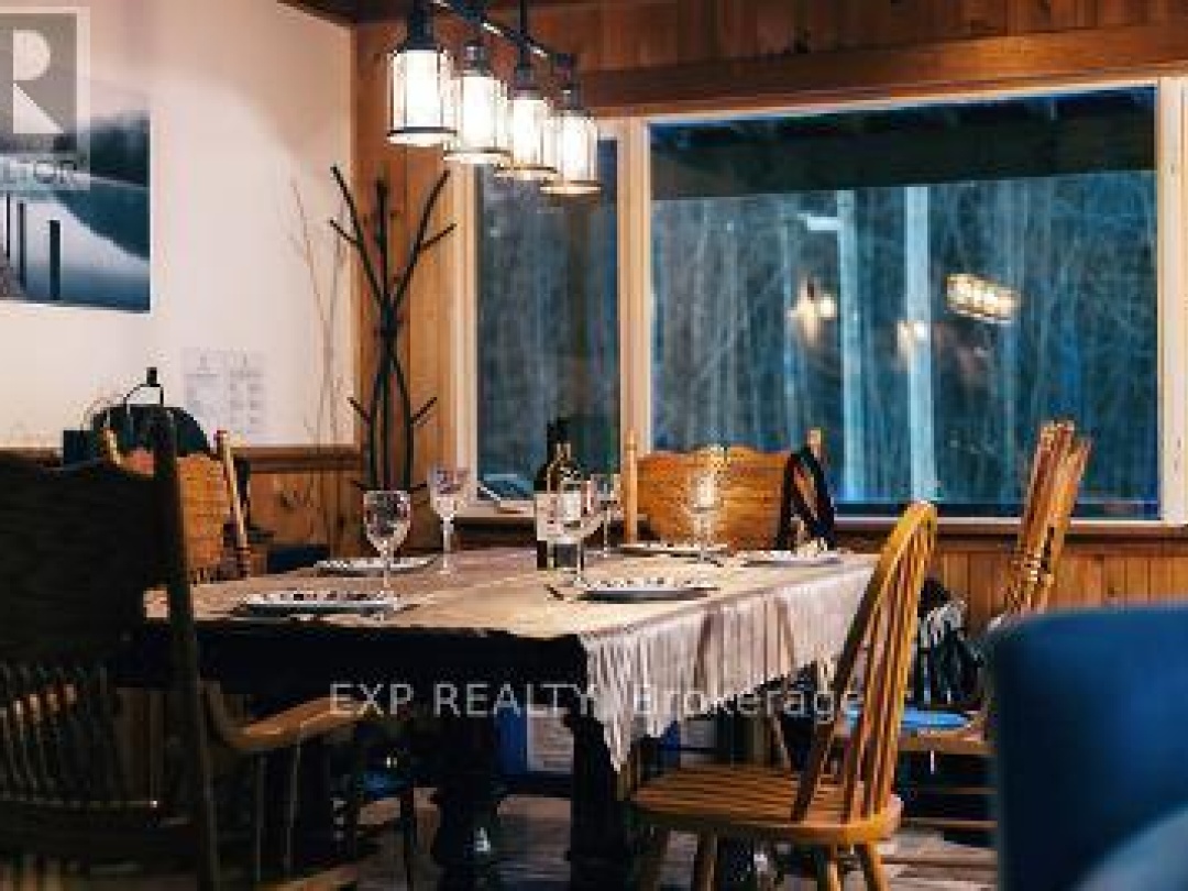
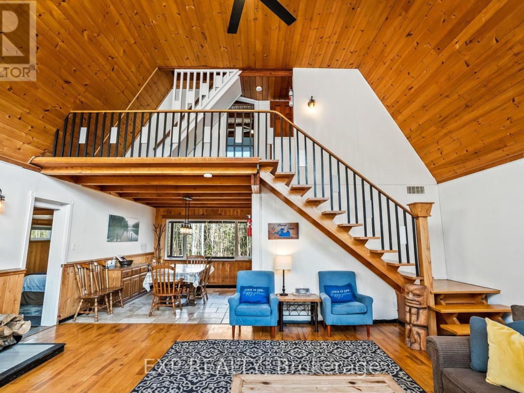
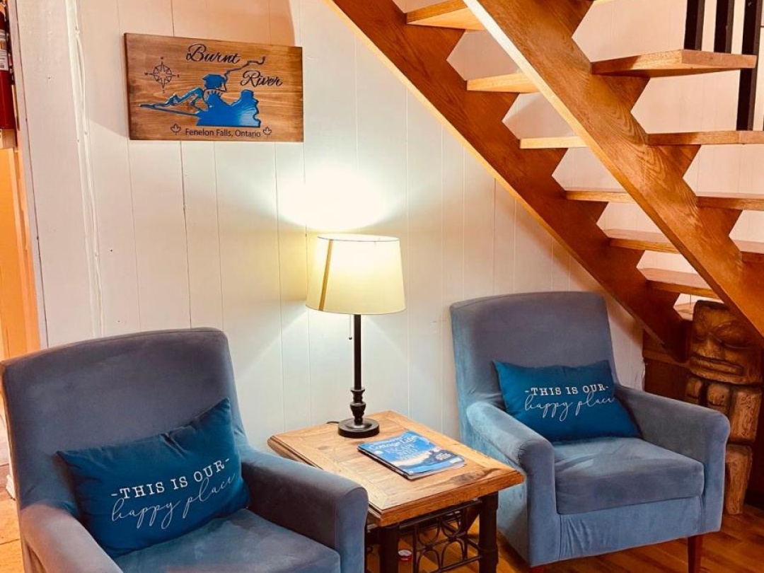
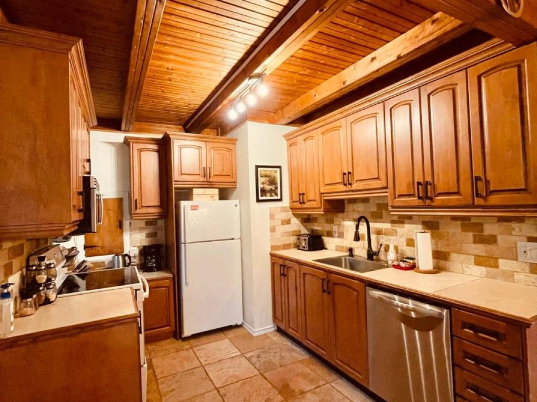
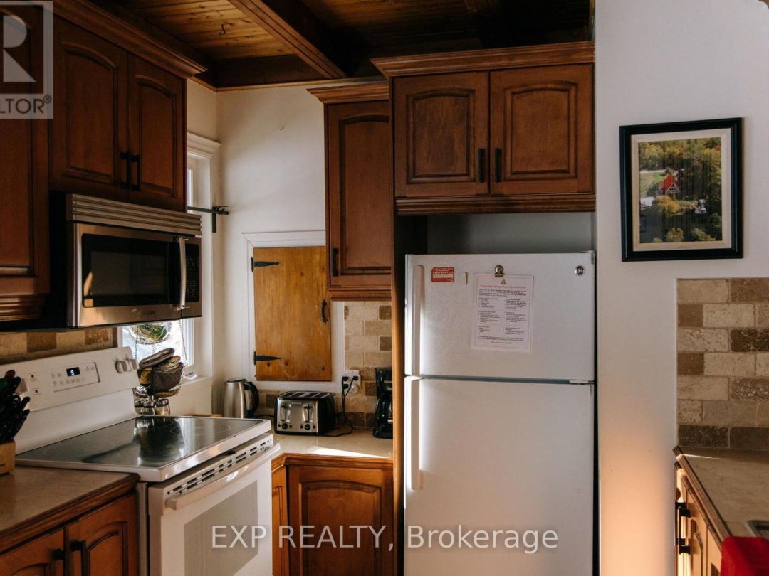
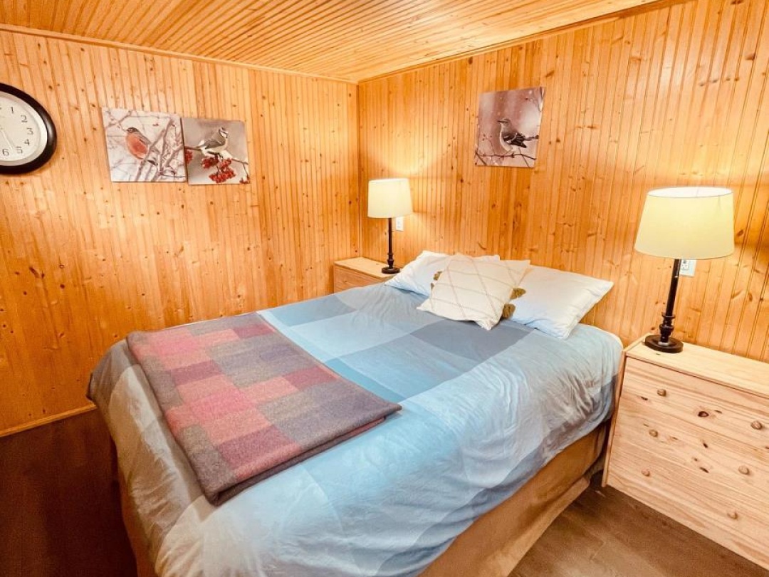
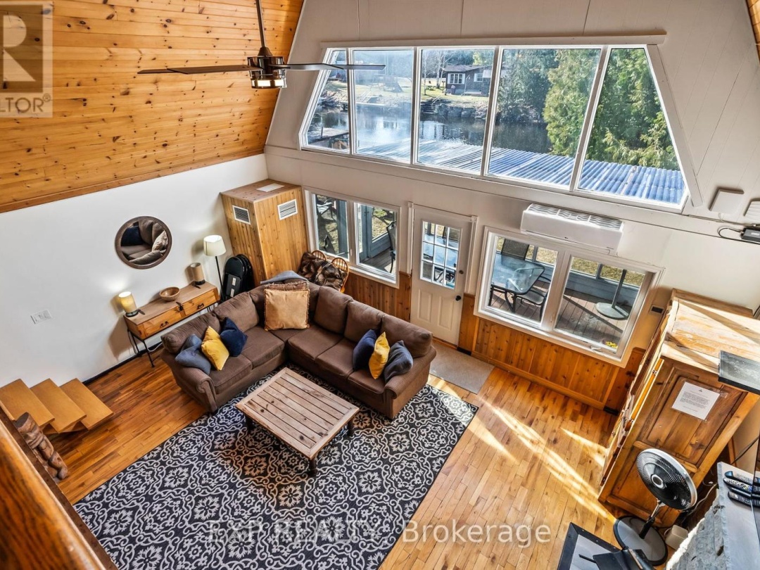
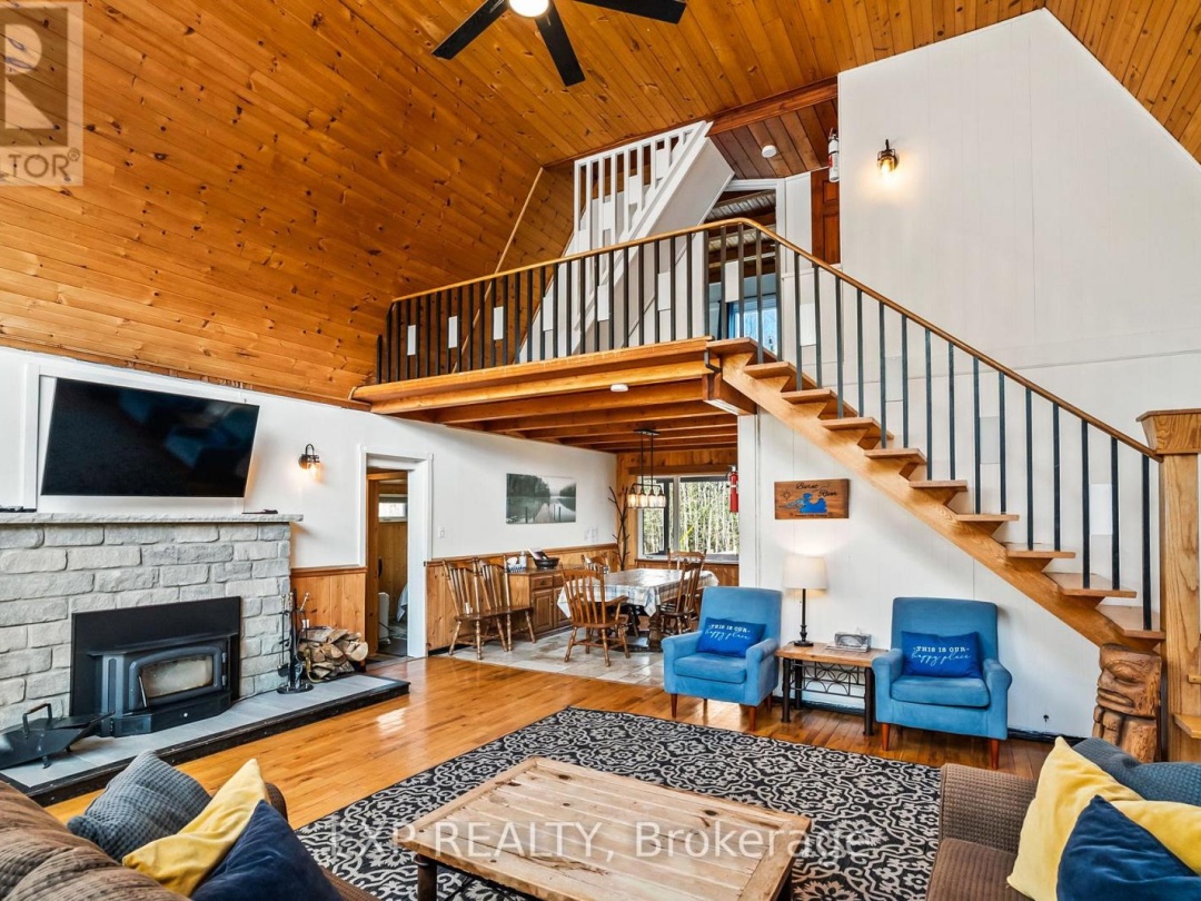
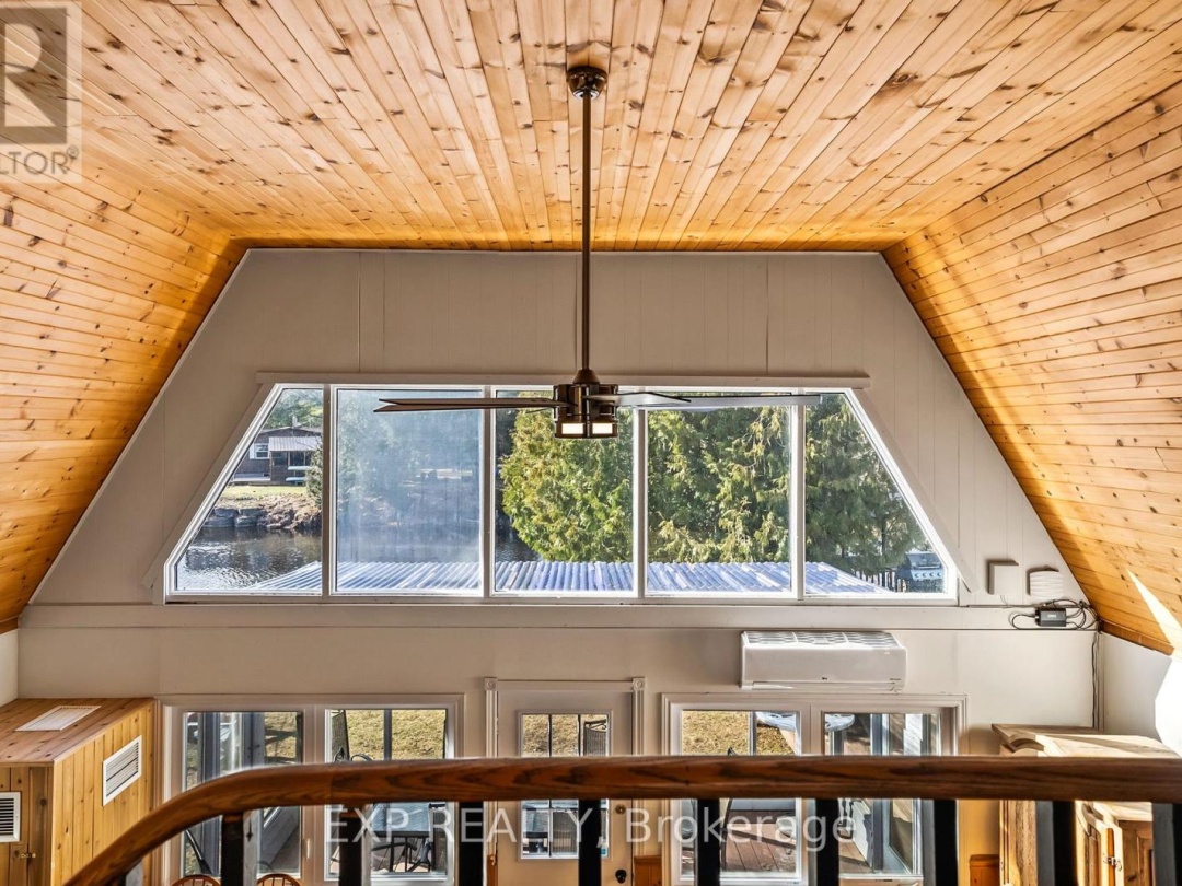
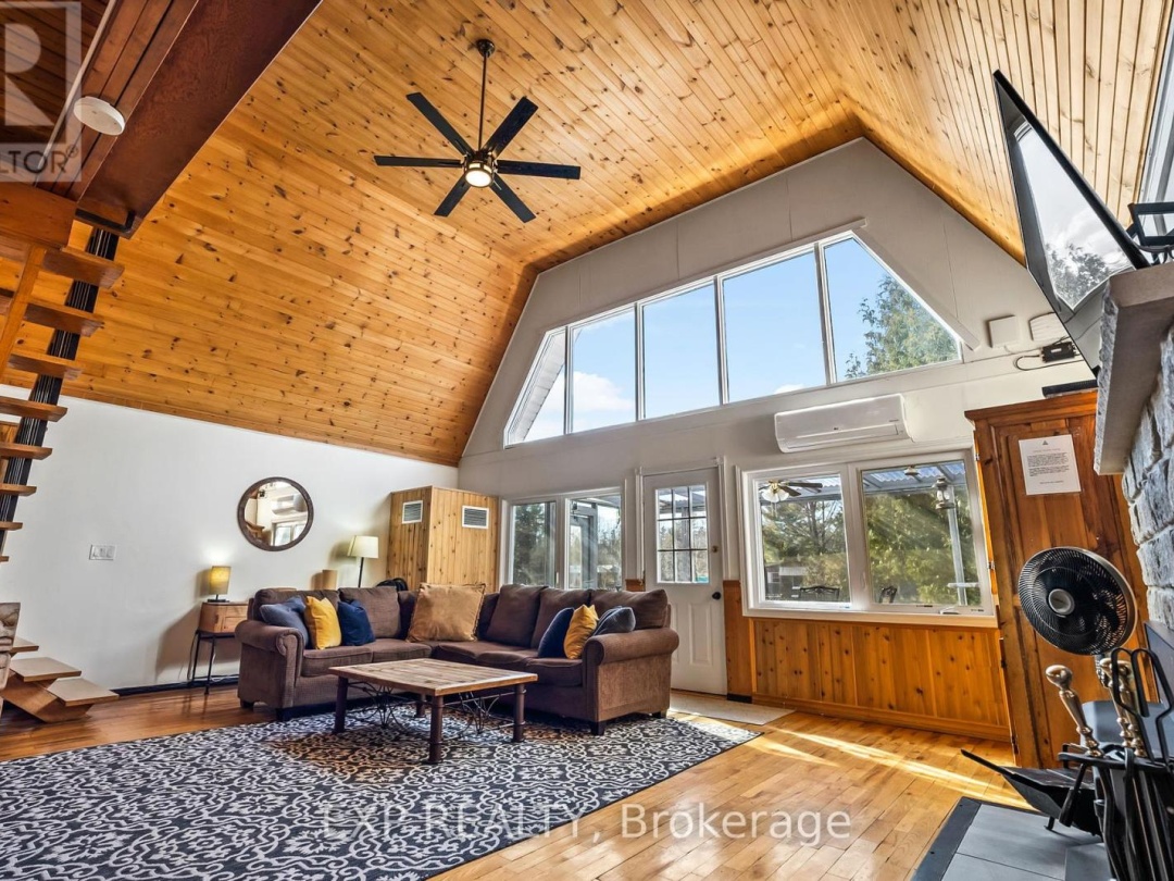
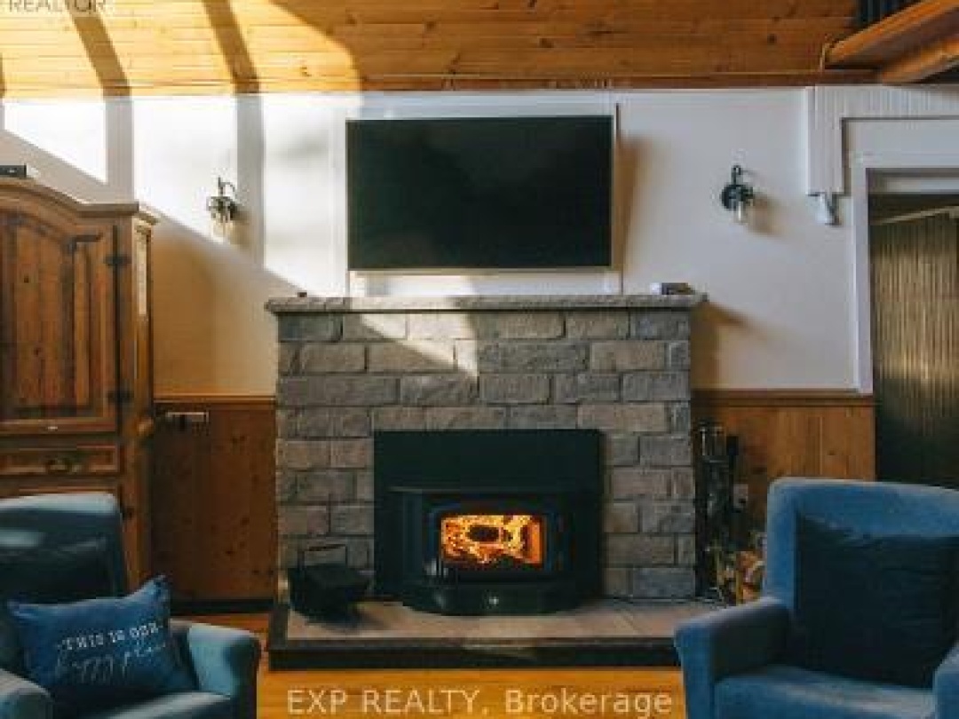
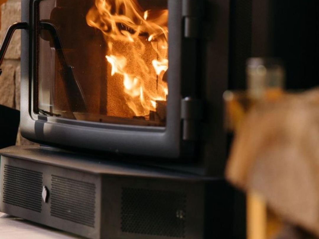
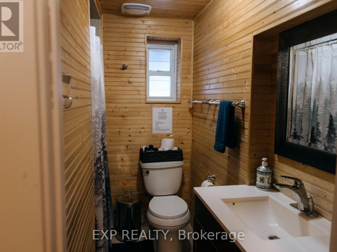
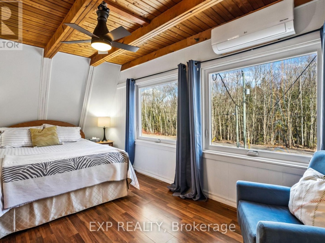
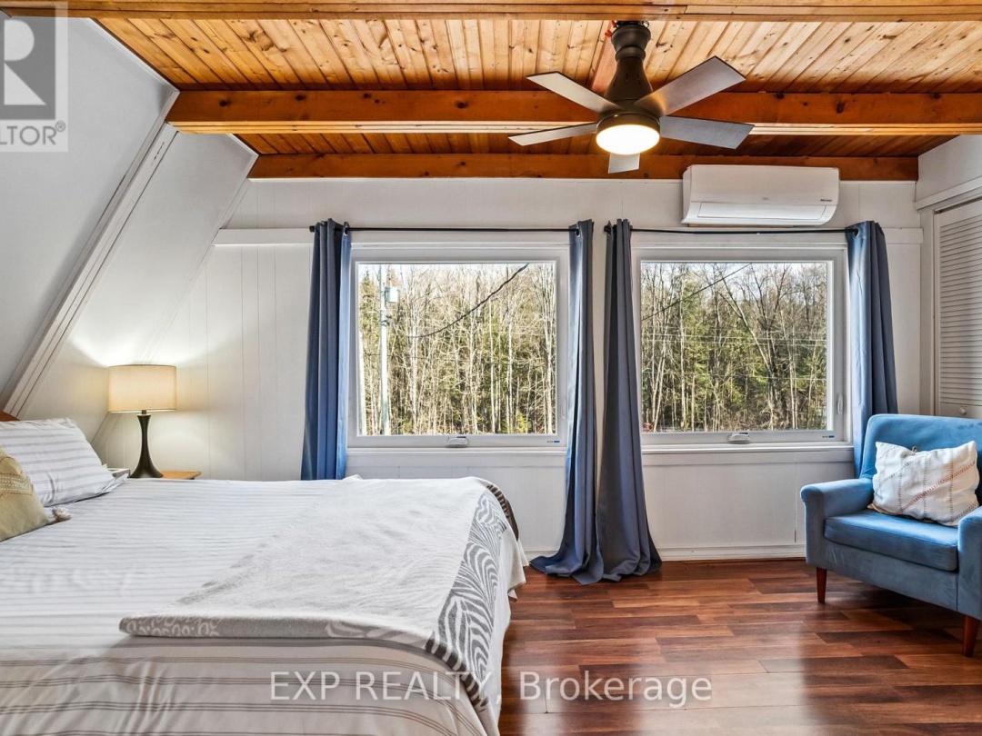
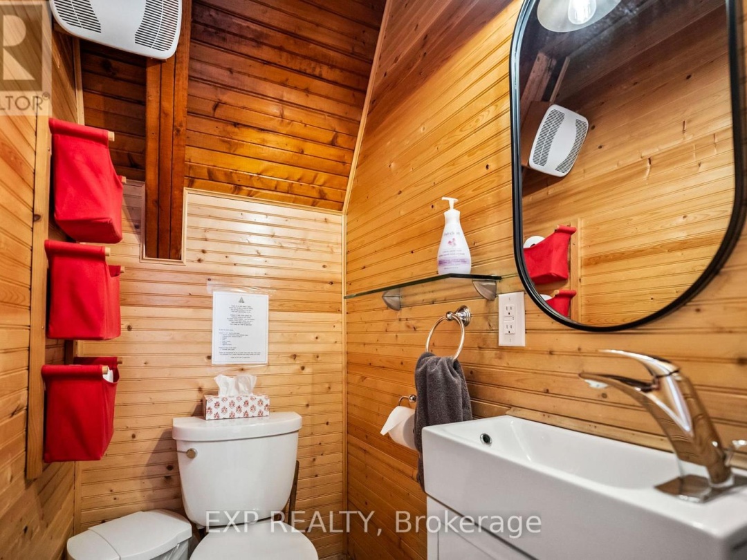
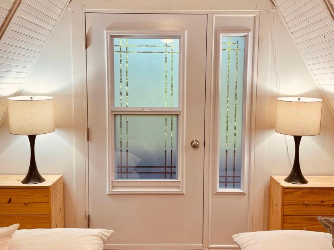
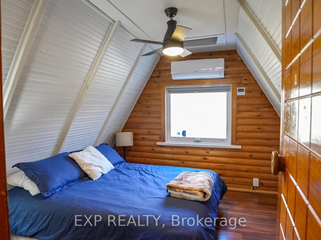
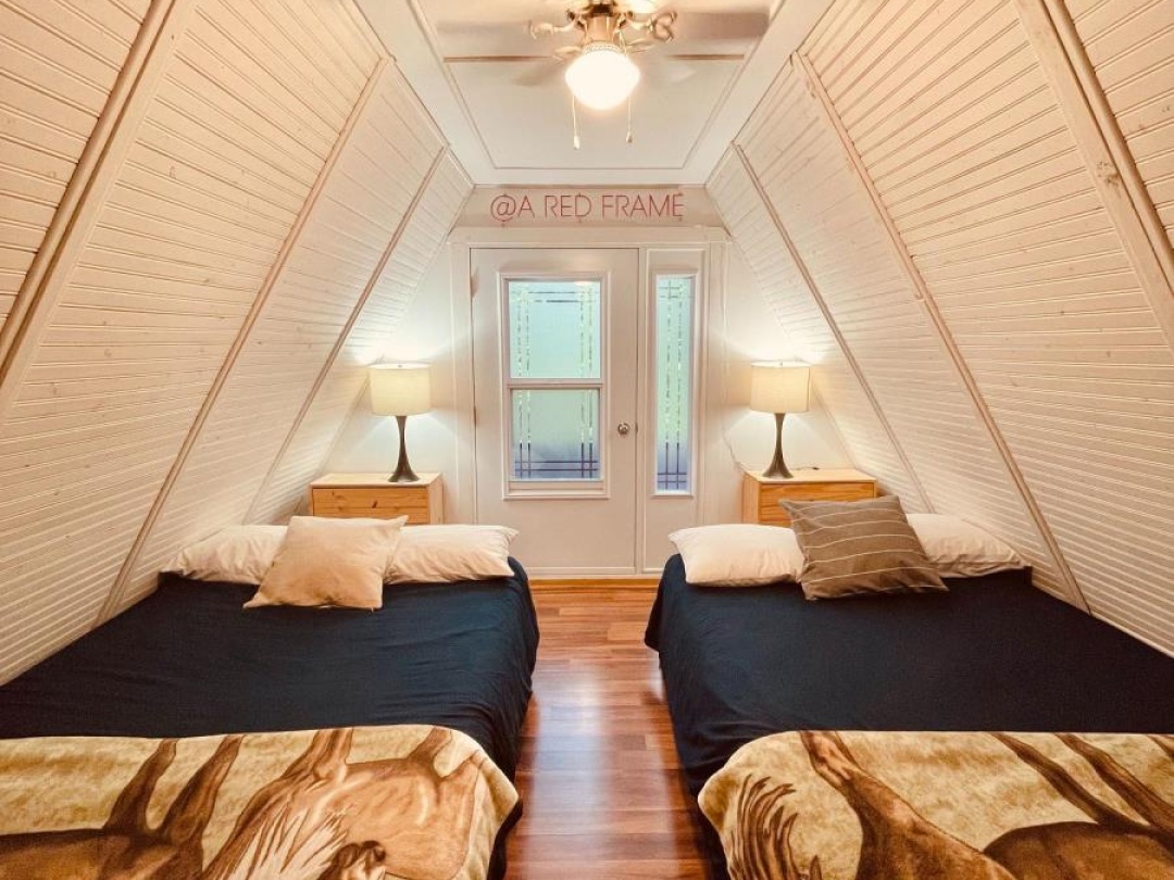
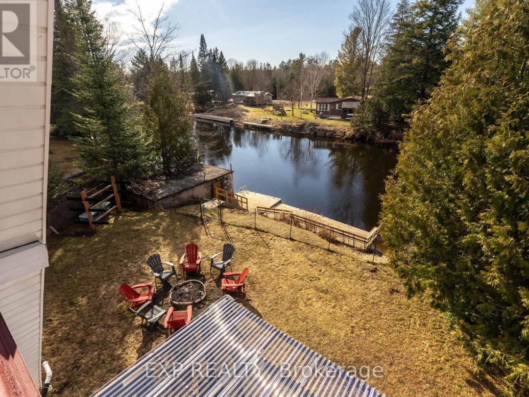
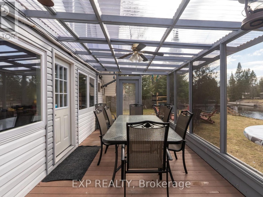
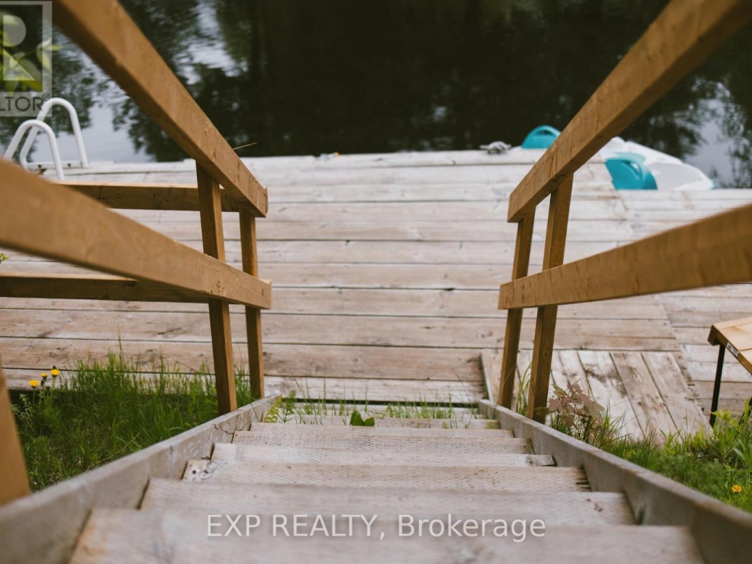
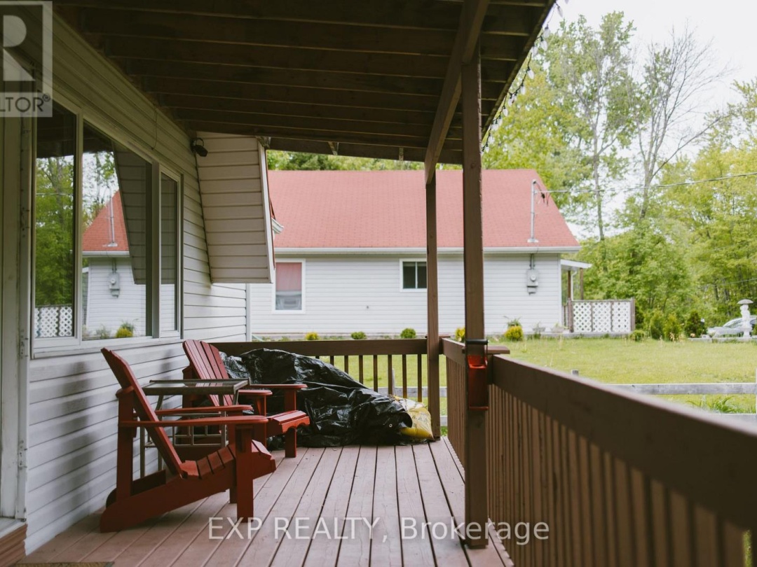
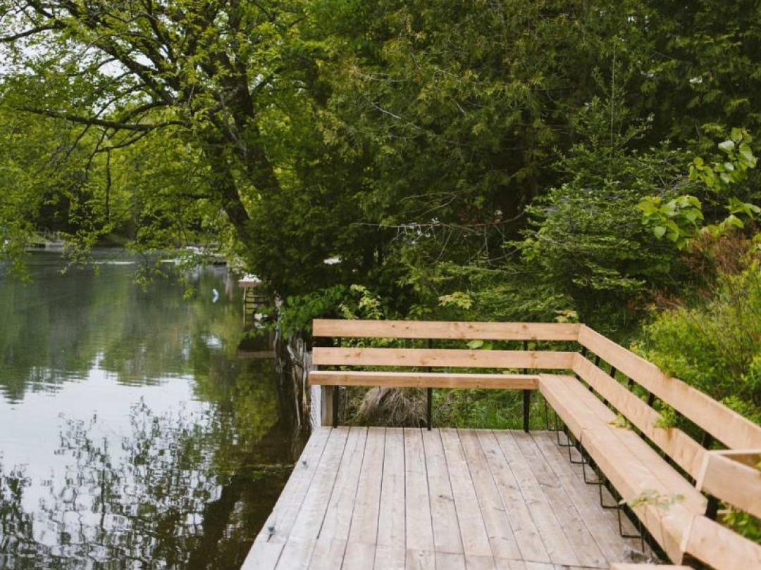
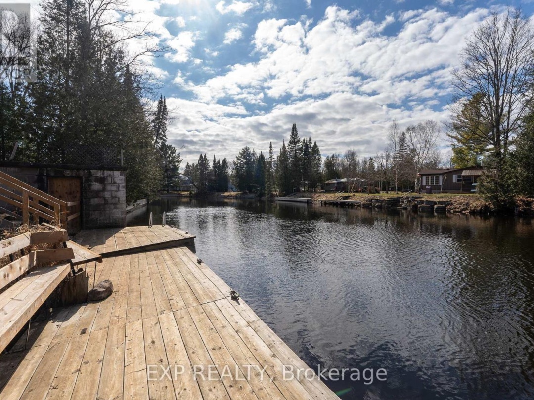
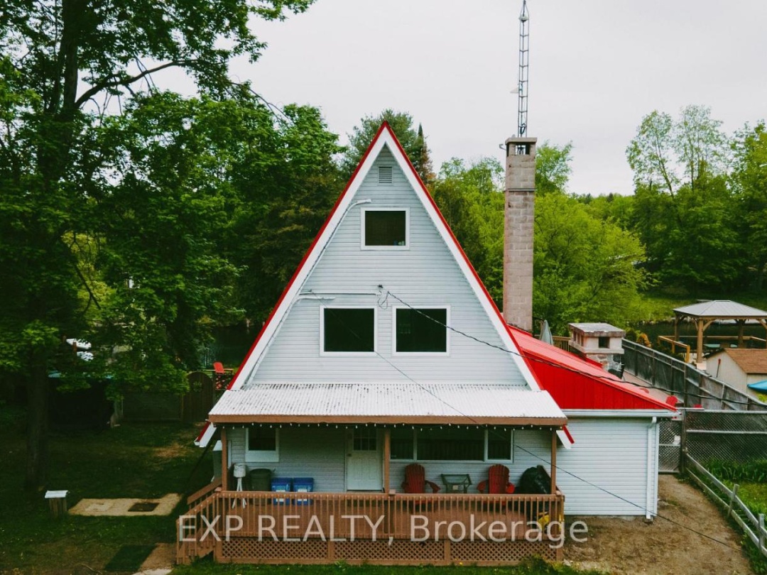
Welcome to A Red Frame a cozy, fully turnkey 4-season A-frame cottage nestled on the banks of Burnt River, just 8 minutes from Fenelon Falls. Whether you're looking for the perfect family escape or a proven investment, this registered Short-Term Rental (STR) has it all; charm, comfort, and cash flow.With its signature red metal roof and storybook setting, this cottage instantly captures your heart. Inside, the open-concept layout boasts a stone-floored kitchen, spacious dining area, and an airy great room with soaring ceilings, massive windows, and a wood-burning fireplace for cozy year-round ambiance.Enjoy bug-free entertaining in the screened-in Muskoka Room, dine under the stars on the expansive deck, or unwind by the hand-chipped granite fireplace and smoker. While you cant launch a boat directly on the property, the private dock offers clean, deep water thats perfect for swimming, lounging, or docking your watercraft after launching nearby.With 4 bedrooms, including a main-floor queen, two additional queen-sized bedrooms upstairs, and a charming river-view room with two double beds, theres room for everyone. Two bathrooms a 3-pc on the main and a shared 2-pc upstairs provide flexible convenience, along with main-floor laundry. Practical upgrades include a fully encapsulated crawl space with spray foam insulation, liner, weeping tile, and sump system. For year-round comfort, youll love the heat pump with air conditioning on every level, plus a backup propane furnace for peace of mind. Whether for summer memories, winter escapes, or rental income, this cottage delivers. Opportunities like this are rare dont miss your chance to own this truly special piece of waterfront paradise at 137 Fell Station Dr. Act fast! (id:60084)
| Waterfront Type | Waterfront |
|---|---|
| Waterfront | Burnt Lake |
| Size Total | 117.4 x 130.4 FT |
| Size Frontage | 117 |
| Size Depth | 130 ft ,4 in |
| Lot size | 117.4 x 130.4 FT |
| Ownership Type | Freehold |
| Sewer | Septic System |
| Zoning Description | LSR(F) |
Building Details
| Type | House |
|---|---|
| Stories | 2.5 |
| Property Type | Single Family |
| Bathrooms Total | 2 |
| Bedrooms Above Ground | 4 |
| Bedrooms Total | 4 |
| Cooling Type | Central air conditioning |
| Exterior Finish | Vinyl siding |
| Fireplace Type | Woodstove |
| Flooring Type | Hardwood |
| Foundation Type | Block, Wood/Piers |
| Half Bath Total | 1 |
| Heating Fuel | Electric |
| Heating Type | Heat Pump |
| Size Interior | 139 ft2 |
| Utility Water | Drilled Well |
Rooms
| Ground level | Dining room | 3.97 m x 3.28 m |
|---|---|---|
| Living room | 6.66 m x 5.26 m | |
| Kitchen | 3.27 m x 2.86 m | |
| Bedroom | 3.57 m x 3.28 m | |
| Bathroom | 1.92 m x 1.8 m | |
| Laundry room | 0.97 m x 2.1 m | |
| Second level | Bedroom 2 | 5.42 m x 3.02 m |
| Bathroom | 1.09 m x 1.58 m | |
| Third level | Bedroom 3 | 3.97 m x 3.28 m |
| Bedroom 4 | 3.87 m x 3.87 m |
This listing of a Single Family property For sale is courtesy of from
Information on Burnt Lake
| Burnt Lake Size | 22 Ha | 54 acres |
|---|---|---|
| Burnt Lake Perimeter | 5.20 km | 14 miles |
| Burnt Lake Depth | 11 m | 72 ft |
| Burnt Lake Mean Depth | 4.80 m | 16 ft |
| Altitude of Burnt Lake | 225 m | 738 ft |
| District | Burnt Lake is in the District of Parry Sound | |
| Municipality | Burnt Lake is in the Municipality of Archipelago | |
| Township | Burnt Lake is in the Township of Conger | |
| Drainage Basin | Moon River | |
| Watershed Area | 3.8 km | 2 miles |
| Water Clarity | Burnt Lake has a water clarity of 6.80 m | 22 ft |
Census Data of Archipelago Municipality
2016 Population of Archipelago: 5312011 Population of Archipelago : 566
Population Growth of Archipelago : -7 %
Total private dwellings in Archipelago : 2,693
Dwellings by residents in Archipelago : 251
Density of Archipelago : 251 per sq km
Land Area of Archipelago: 251 sq km
Archipelago is in the District of Parry Sound
Census Data for The District of Parry Sound
Population: 42,824 (2016) 1.6% increase over 2011 population of 42,162The total number of dwellings is 35,226 of which 18,679 are full time residents
The land area of Parry Sound is 9,326 sq km's (3,601 sq miles) and has a density of 5 per sqare km
Data is from the 2016 Government Census